I have always loved reading fantasy. The Chronicles of Narnia, The Lord of the Rings, and The Wheel of Time were the series that defined my childhood. (Well, Wheel of Time lasted longer than my childhood. Robert Jordan passed away while I was in college.) Since then, I’ve enjoyed the works of Brandon Sanderson, Sarah J Maas, George RR Martin, Sabaa Tahir, and more. One of the best parts about reading fantasy is opening up one of those doorstopper volumes to admire the map. When I started my Steel & Fire series, I was excited to finally create my own fantasy map.
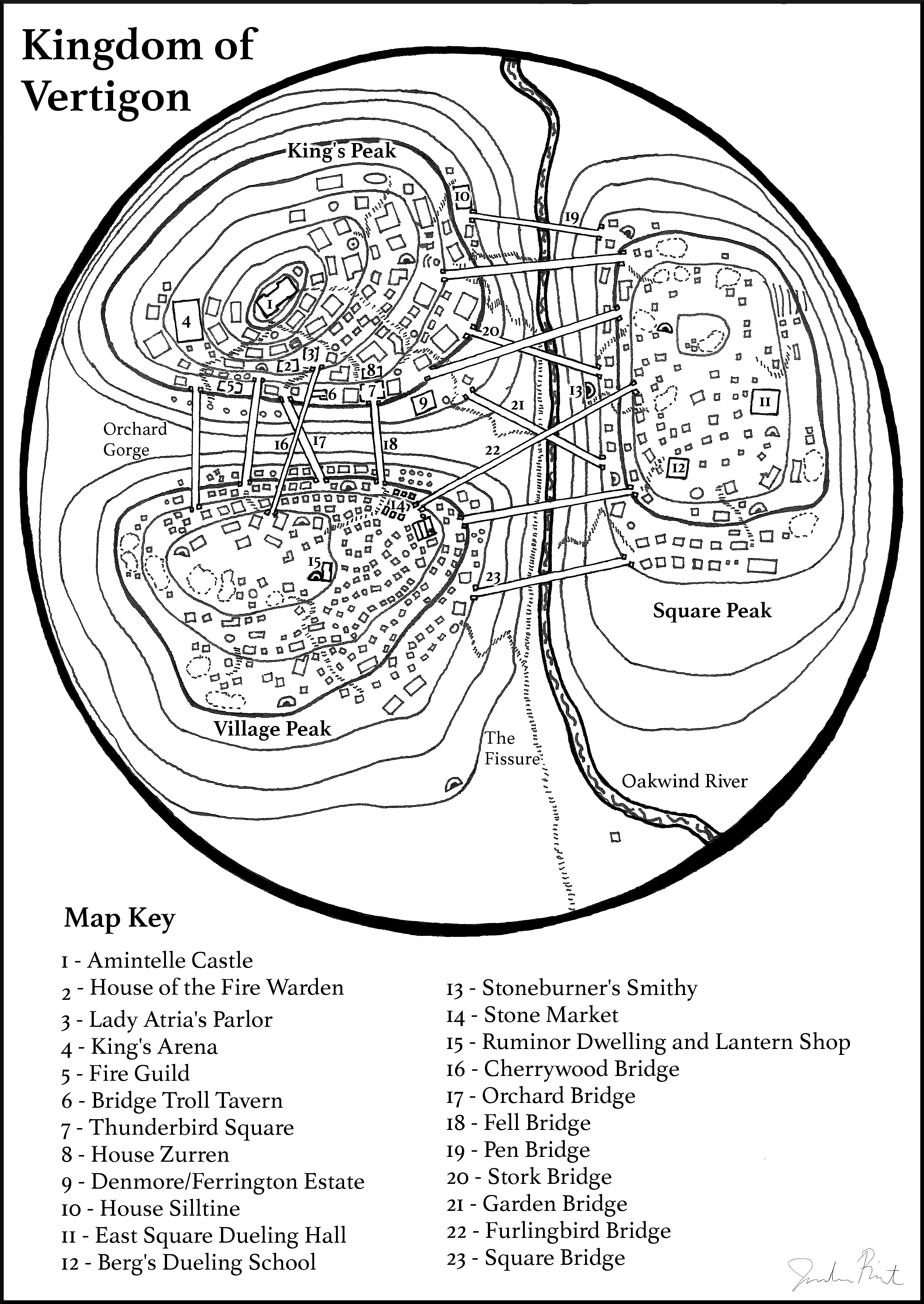
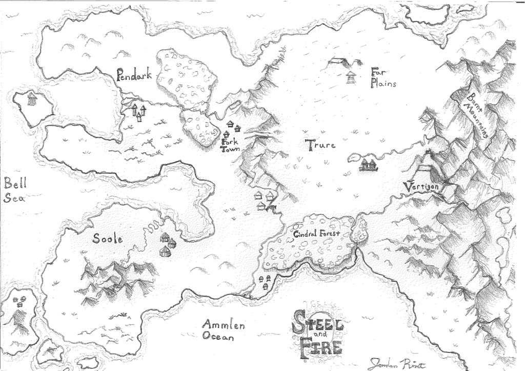
I knew the shape of my main kingdom early on. Vertigon is a mountaintop realm with three distinct peaks: King’s Peak, Village Peak, and Square Peak. A multitude of bridges span the gaps between the peaks, providing all kinds of opportunities for cool scenes. While I worked on the rough draft of the first book, Duel of Fire, I slowly expanded on my ideas for the world outside Vertigon. I knew there was a distant land called Pendark, with a turbulent past and a magic substance distinct from the Fire of Vertigon. Trure was Vertigon’s closest neighbor and ally. Soole was as far away as–and even more mysterious than–Pendark. Eventually these ideas developed to the point where I needed to figure out exactly where these places were located before I could finish the first book and plan the next one.
Once I knew enough about the world in my head, I went straight to YouTube. I found a wonderful video series about how to create your own fantasy map. You can find the videos here. I laid out all my favorite fantasy maps for reference and inspiration and got to work, following the steps in the first few videos closely.
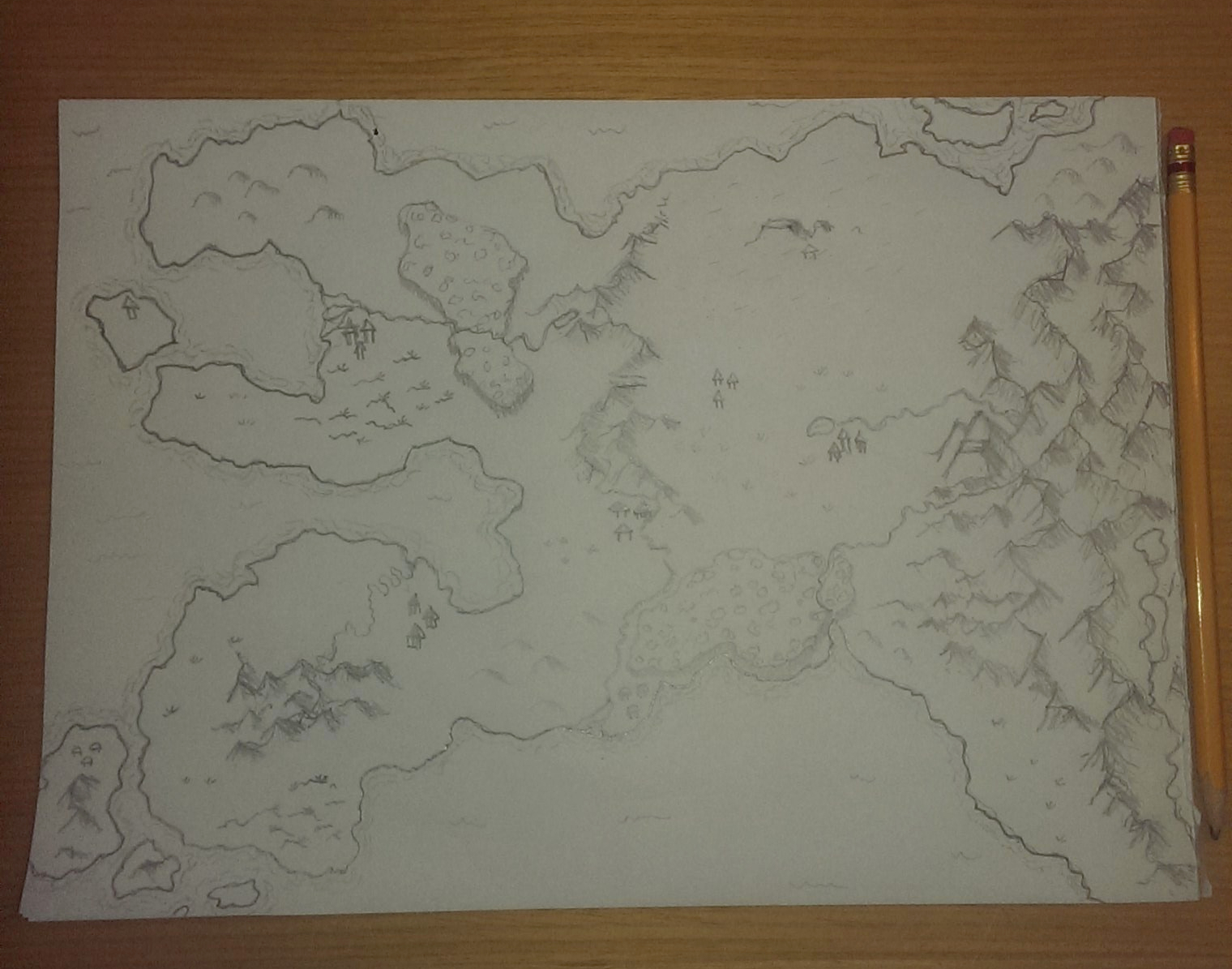
I did the initial drawings in pencil and worked through several versions in increasing detail. I also sketched the rough shape of other continents in the world, which I may or may not explore in a future series. They’re referred to only as the “lands beyond” the Bell Sea and the Ammlen Ocean in the series. When I was satisfied with the design, I went over everything in darker pencil and wrote the place names by hand.
At that point I scanned the pencil drawing and used Gimp (a free and less powerful version of Photoshop) to darken and smooth out the lines. I also decided to erase the rough hand lettering and replace it with typed names as it gave me more options for changing the size and adding in place names later.

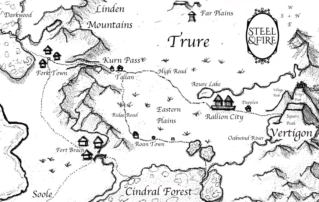
I decided not to label every town and river from the beginning. My characters don’t leave Vertigon until Book 3, so that was when the details of the rest of the continent became more important. I’ve slowly been adding to the map with each volume. For Book 3, I zoomed in on Trure and added additional details as the different roads are important in that novel. Otherwise, I preferred to stick with a fairly clean design with only cities and natural features included.
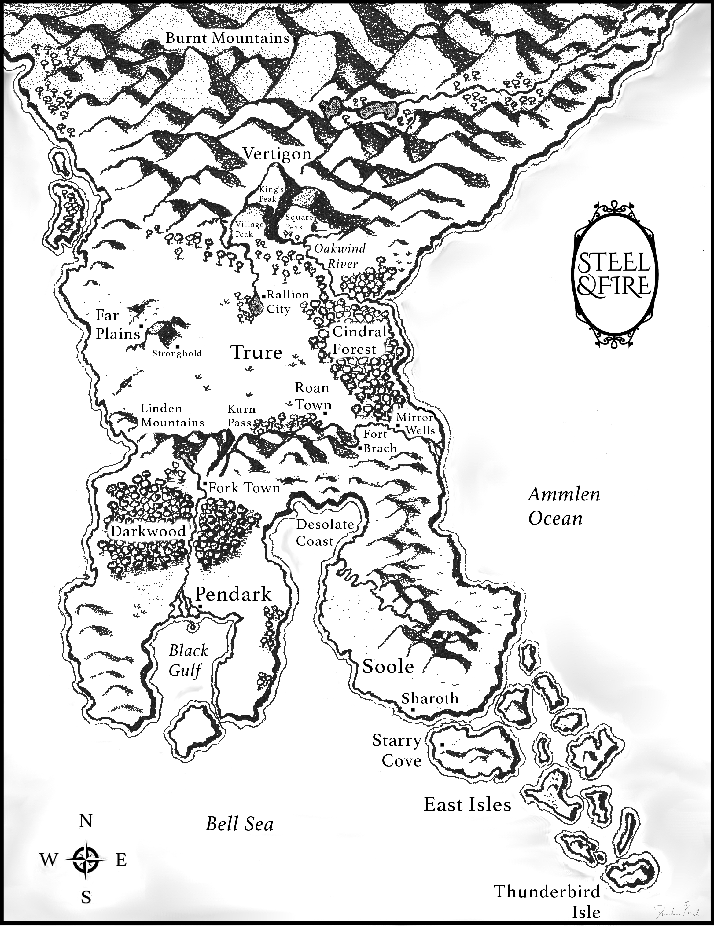
The Steel & Fire series is now complete and with it the final version of the map. I am now in the planning stages for an all-new series set in a different world. This time I’ll do more work on outlining the complete series before creating the map. There were times when it would have been convenient for the continent to be shaped differently or for distances to be shorter than they were in my map. I’m hoping to avoid some of those issues the next time around. (I also made the mistake of orienting the map so that west is at the top and north is on the righthand side. I’ll definitely stick with a traditional compass next time around for simplicity’s sake.) I’m already looking forward to building my next world!
So, what’s your favorite fantasy map? Have you ever tried to make one yourself?
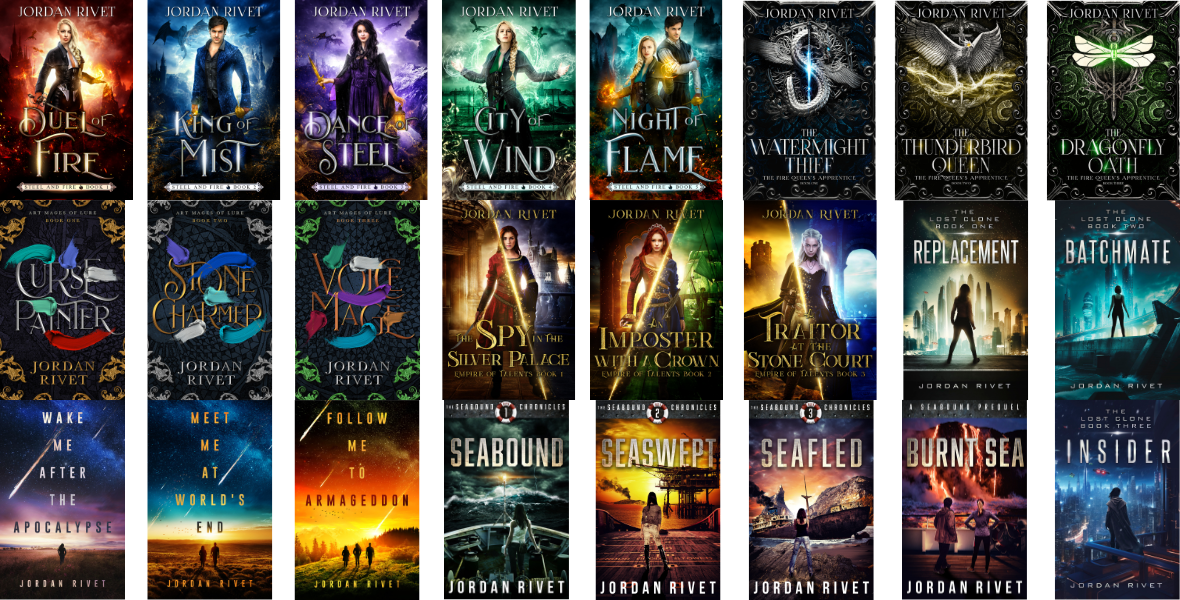
Don’t forget to check out the Steel and Fire series, a swashbuckling YA fantasy full of sword-fighting, banter, romance, and adventure. Happy reading!
PS. I have an Instagram account, @Jordan_Rivet_Books, where I sometimes post progress photos of my maps. See you there!
2024 UPDATE!
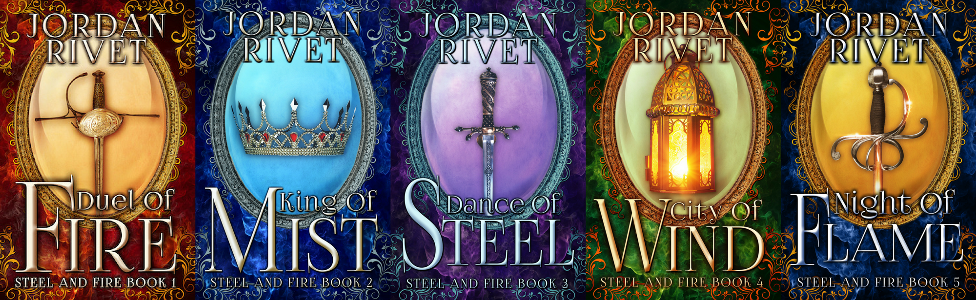
It has been a few years since this post, but it still brings in a fair bit of traffic. I thought you might like to see my more recent fantasy maps, starting with a new version of the Steel and Fire map, which I made for the 5-year anniversary editions:

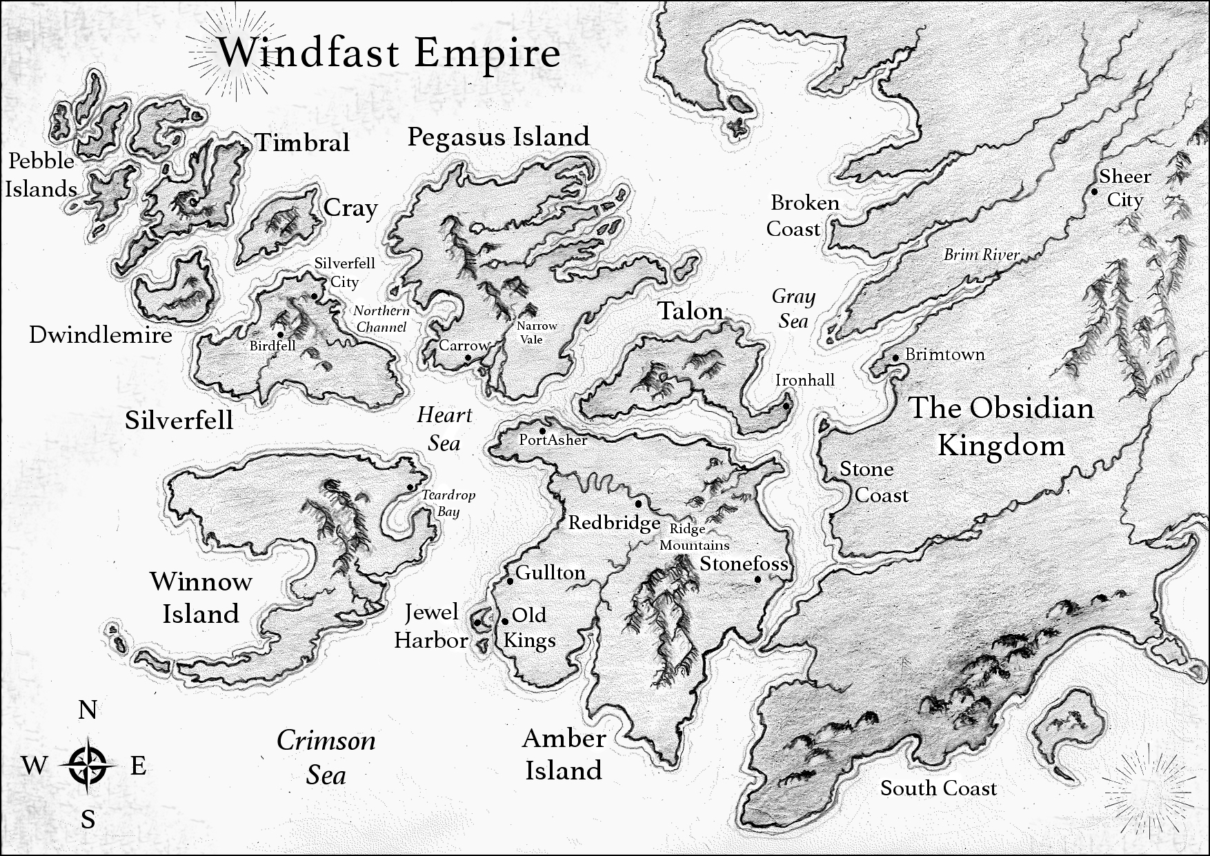
This next one is my favorite map because it was fun to draw all the little islands. The Empire of Talents trilogy takes place in a decadent fantasy empire full of intrigue and glamor. The characters travel to quite a few of these islands throughout the series, and my goal was to make it look and feel very different from the world of Steel and Fire.
Next up is the map for the Art Mages of Lure trilogy, which is a classic fantasy adventure inspired by Robin Hood. Naturally, this map resembles England, where the folktale originates. I especially liked adding in the forests and the mountain stronghold, Narrowmar, at the top.

Finally, I created several new maps for the hardcover special editions of the Steel and Fire series. Here’s one of them, a contour map of the three peaks of Vertigon. It was interesting to try a different approach to mapmaking and see what I could do. I think it looks like a cell diagram! You can find more details about the hardcover special editions here.